YellowScan - CloudStation - Turn physical projects into digital realities
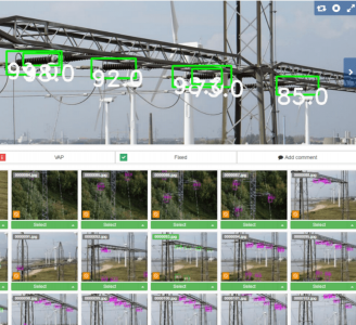
The CloudStation is an evolutive and user-friendly software, developed by YellowScan, to generate and visualize pointclouds.
Want to try CloudStation? Take advantage of our 30-day trial!
The Detail
Extract, process, and display LiDAR data right after a flight
- Visualize datasets with billions of points in no time
- Effortlessly handle multi-flight acquisitions in a single project
- Auto-generate strips and export .LAS files to interface with all your tools.
Increased productivity
Get the job done faster with this intuitive pointcloud extraction tool that will maximize your budget.
In-house research and development
Our goal is to develop our skills and technologies to better serve our customers. Our R&D team strives to innovate, develop new functionalities and improve the CloudStation on a day-to-day basis.
Get expert advice and guidance
YellowScan’s knowledgeable team is here to support you, be it for a quick consult or training.
The CloudStation comes with a 1-year maintenance, including support and software updates.
Key features
- Automatic or custom strip selection
- Project settings: Coordinate system, LiDAR profile, angle range…
- Powerful 3D Engine
- Vertical slicing
One click exports
- LAS/LAZ (1.2/1.4) files
- A DSM as GeoTIFF (geolocalized TIFF)
Add-on modules
Improve the quality of your surveys with our custom-made modules.
Strip Adjustment
Modify strips or flight lines and enhance the quality of your pointcloud.
Key Benefits:
- One-click adjustments
- Powerful algorithms used in adjustment methods
- Use Ground Control Points (GCPs) for final adjustments
- Seamless adjustment of strips
Terrain
Export classified pointclouds
Key Benefits:
- Export classified .LAS
- Generate hill shade from your DTM
- Automatic classification of points as “ground/non-ground”
- Export Digital Model from your classified point cloud as GeoTIFF (geolocalised TIFF): DSM, DTM, DHM.
Colorization
Export colorised pointclouds from simultaneous LiDAR + camera acquisition
Key Benefits:
- Combine the data generated from your flight with photos taken simultaneously to generate a colorised pointcloud
- Colourise and visualize your strips
- Automatic LiDAR–camera calibration and refinement
- Two colourisation methods available
- Designed for our camera hardware
- Colourisation from external orthophotos available
Want to try CloudStation? Take advantage of our 30-day trial!
You may also like
Heven Drones
H100
CALL FOR ASSISTANCE
The H100 represents the beginning of Hevens heavy lifter drones.
Product Detail
tlmNexus Ltd
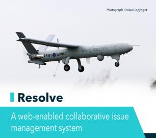
RESOLVE
CALL FOR ASSISTANCE
Tool overview: what will Resolve solve for me?Equipment issues that affect airworthiness, saf
Product Detail
Microbyte Solutions Ltd
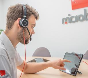
Telecoms
CALL FOR ASSISTANCE
Complete telecoms for a fixed monthly feeWhen it comes to business grade telephone solutions,
Product DetailALTI
Reach - VTOL UAV
CALL FOR ASSISTANCE
The ALTI Reach is the upcoming 'bigger brother' to the ALTI Transition.
Product Detail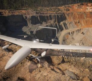
Teal Consulting

Developing Collaborative Business Relationships
CALL FOR ASSISTANCE
Developing Collaborative Business Relationships - ISO 44001Organisations have long recognised tha
Product Detail
DRONE TRACKING TECHNOLOGIES
The P-Series VAD drone detection system
CALL FOR ASSISTANCE
The P-Series VAD drone detection system
Product DetailIntelligent Energy

2.4 kW Fuel Cell Power Module
CALL FOR ASSISTANCE
Lightweight power module for UAVs and other portable applications
Product DetailTeal Consulting

Operational Excellence
CALL FOR ASSISTANCE
Teal Consulting - Operational ExcellenceOperational excellence is crucial to businesses achieving
Product Detail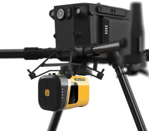
DRONE TRACKING TECHNOLOGIES
The F-Series VAD drone detection system
CALL FOR ASSISTANCE
The F-Series VAD drone detection system.
Product DetailYellowScan
Voyager - Precision meets reality
CALL FOR ASSISTANCE
The YellowScan Voyager is our highest range LiDAR solution with a range of up to 760m (2493 ft.)
Product DetailMicrobyte Solutions Ltd
White Label 24/7 IT Helpdesk
CALL FOR PRICE
You can outsource your IT Helpdesk from only £500 a month.Microbyte White Label boosts your suppo
Product Detail